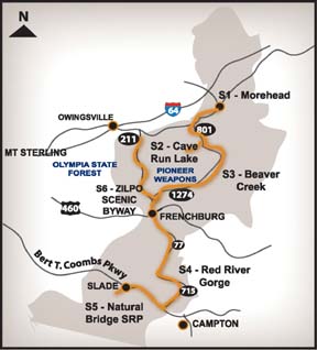
Starting Point: Starting in Morehead this trail allows you to visit Minor Clark Fish Hatchery, Cave Run Lake, Red River Gorge, Natural Bridge State Park and Zilpo Scenic Byway.
S1 – Morehead
The Art & Soul of Kentucky- Visit the only museum of Kentucky Folk Art. Morehead, where the bluegrass meets the mountains, is not only a great place to live, but a beautiful area to bring your family for that much needed vacation. Morehead's primary tourism market is the outdoor market. Located in the beautiful Daniel Boone National Forest and near Cave Run Lake, the Morehead area is the location of fishing, hiking, boating, camping, observing wildlife, and golf. Morehead is also home to a rich heritage of music, arts and crafts and the home of Morehead State University . . .Kentucky's "University To The Mountains".
Minor Clark Fish Hatchery: From Morehead take US 60 to Farmers to 120 Fish Hatchery Road.
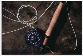
Below Cave Run Lake dam is the Minor E. Clark Fish Hatchery, operated by the Kentucky Department of Fish and Wildlife Resources. This state fish hatchery is one of the largest warm-water fish hatcheries in the nation. The hatchery produces nearly four million fingerlings annually, that are released into Kentucky lakes, rivers and suitable streams. Largemouth bass, smallmouth bass, muskellunge, striped bass (rockfish), hybrid striped bass, and walleye are some of the sport fish reared at the hatchery. During the summer months, an outdoor viewing tank is open for viewing many of the larger fish species.
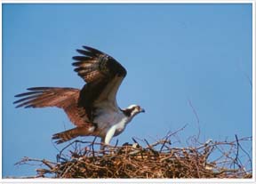
While visiting the hatchery, bring your binoculars, since this is one of the premier birding spots in Eastern Kentucky. Watch for raptors, shorebirds, wading birds, waterfowl and swallows. Bald eagle and Osprey. Check empty ponds for Pectoral, Spotted and Least Sandpipers, Lesser Yellowlegs, Semipalmated Plover, and Killdeer. Also look for Great Blue and Green Herons, Great Egrets, Wood Ducks, Purple Martins and Cliff Swallows. The hatchery grounds are open year-round during daylight hours.
S2 – Cave Run Lake
Located about 60 road miles east of Lexington, Kentucky. Exits 123, 133 and 137 off I-64 provide the primary access routes to the lake area. Gas, lodging, and dining opportunities available in nearby Morehead.
Habitat and trail info: Cave Run Lake is located within the scenic Eastern Highlands region of Kentucky in Bath, Rowan, Morgan and Menifee Counties. The 8,270-acre lake is surrounded by the northern-most section of the Daniel Boone National Forest and offers many recreational opportunities. The dam forming the lake is on the Licking River, 173.6 miles above its confluence with the Ohio River.
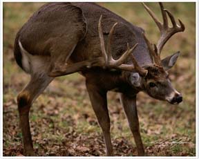
Wildlife Viewing Opportunities: Deer, turkey, grouse, squirrel, fox, and raccoon can be found here.
Fern Bluff Trail, a self-guided trail focusing on forest ecology, loops around the Visitor Center. A bird blind and feeders are available for your pleasure
Shallow Flats Wildlife Viewing Area, a handicapped accessible viewing platform with spotting slope allow you to view the shallow wetlands. This area is home to the giant Canada Geese, once extinct from eastern Kentucky. Mallards and other waterfowl can be seen enjoying the area.
Wetland Interpretive Trail, teaches the importance of wetlands as you hike along a short trail. A handicapped accessible platform with a viewing area overlooks the wetlands and offers many opportunities to see nature up close.
Wildlife Habitat Trail, a self-guided trail through the forest, wanders past a stream, grassy opening, and pond, for a chance to view one of many forest critters that make this area their home. This .75-mile trail begins at the Boat Gunnel Picnic Area.
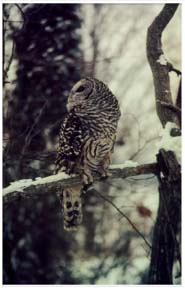
Twin Knobs Recreation Area and Campground. There are hiking trails, restrooms, swimming beach and store for your convenience. Deer, foxes, turkey and squirrels are common sights. At night, listen for eastern screech owls, whip-or-wills and frogs. Daylight brings a melody of songs from towhees, common yellow throat, prairie warblers, bluebirds and indigo buntings and many others, including cerulean warblers. Some trails are handicapped accessible. A day use fee is charged to enter Twin Knobs Recreation Area if you are not camping.
S3 – Beaver Creek Wetlands
From Morehead Ranger District Office and Visitor Center follow KY 801 South to the junction of KY 1274 (continue straight). Follow KY 1274 west to Longbow Marina. The wetlands continue on left side of the highway for approximately 2 miles. Distance 15 miles. Gas, lodging, and dining opportunities available in nearby Somerset or Whitley City.
Habitat and Trail info: The Beaver Creek Wetlands is a series of restored wetlands on the backwaters of Cave Run Lake, covering over 300 acres along Beaver Creek in Menifee County. The land once used for agriculture is now restored to prairie grass fields mixed with bottomland hardwoods. Pull-offs along the road offer parking to enjoy the wetlands.
Wildlife Viewing Opportunities: Plied-billed grebe and hooded merganser nest here, as well as common yellow throat, prairie warblers and many other species of birds. Be sure to check out the sky, hawks, eagles and osprey can be seen riding the wind high above Cave Run Lake or resting on the osprey platform. Deer, beaver and other small mammals can be viewed using the wetlands.
S4 – Red River Gorge
From Beaver Creek Wetlands continue W on KY 1274 to KY 36. Turn left on KY 36 & 460. Turn right on KY 77. Turn left on KY715 to the Gladie Historical Site and Cultural-Environmental Center. Distance: 47 miles. Gas, lodging, and dining opportunities available in Slade.
Red River Gorge National Scenic Byway: Begins on Hwy 11/15 in Stanton and runs east to Hwy 77 then north to Hwy 715 east past Gladie Historic Site to Hwy15 in Pine Ridge then west to Slade then south on Hwy 11 past Natural Bridge State Resort Park and ends in Zachariah.
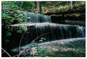
The Red River Gorge contains hundreds of miles of stunning sandstone cliffs that were cut and exposed by the slow, erosive power of the Red River. The unique geology of this area created conditions that affected its use by plants, animals, native peoples and modern visitors. The varied topography provides habitats for a number of rare plants and animals.
Rock overhangs, scattered throughout the cliffline, sheltered native peoples for thousands of years and permitted them to develop agriculture as a sustainable way of life. This area is one of only four known "origins of agriculture" in the world, and the archaeological record of these peoples is still being studied. Visitors enjoy the Red River Gorge for the over 100 natural arches that can be found in the area. A few can be seen from the driving route, some can be found off of maintained trails, while many more must be found by the adventurous. The Red River Gorge is also rated as one of the top rock climbing areas in the world because of its cliffs.
Because of its special nature, the area was designated as the "Red River Gorge Geological Area" in 1974 and it is managed by the U.S. Forest Service to protect its unique species, habitats, and geology while providing recreation opportunities for its visitors.
Habitat and trail info: The Red River Gorge is a great place for the hiker. Over 60 miles of trails are located in the Gorge. Trails range from short, easy hikes to overlooks, all the way to arduous, multi-day trips in the backcountry. A sightseeing drive through the Red River Gorge offers a variety of scenery, but the real treasures exist in the wild, on and off the trails.
The Red River Gorge is wonderful for day hikes and overnight trips. Primitive camping areas exist along Tunnel Ridge Road, Chimney Top Road, and Rock Bridge Road. These are usually open fields that may contain vault toilets, but there is no treated water. Backpackers will want to know that backcountry camping is allowed, but please practice low impact camping in the backcountry and obtain the required recreation permit for parking overnight. Permits can be purchased from the Stanton Ranger District Office, Gladie Historic Site, and many local stores. Special regulations restrict camping to prevent impacts to this sensitive area. Call ahead for information.
Koomer Ridge Campground, located on the south side of the Red River Gorge provides developed camping opportunities. A bathhouse, water, and camper sites are available. No reservations are taken. For more information contact the Stanton Ranger District Office at 606-663-2852.
Wildlife Viewing Opportunities: Deer, turkey, and many species of migrant and nesting warblers in spring and summer and resident songbirds. This area has been designated as a "Globally Important Bird Area" by the American Bird Conservancy. A small herd of bison can be viewed at the Gladie Historic Site.
S5 – Natural Bridge State Resort Park
1-800-325-1710 Start on L&E Railroad Pl. Turn right on Natural Bridge Rd. Distance: 2 miles. Gas, lodging, and dining opportunities available in nearby Slade.
Natural Bridge State Resort Park is home to the great natural sandstone arch that stands like a sentinel over this mountain hideaway. Located in the midst of the Daniel Boone National Forest, near the Red River Gorge Geological Area, the arch spans 78 feet in length and 65 feet in height. Visitors will find this park a kaleidoscope of spectacular natural beauty with each passing season. You can hike or ride the sky lift up to 900 tons of ancient rock suspended across a mountainside and nearly 1000 acres of beautiful nature preserve located in the state park.
Habitat and trail info: The nine hiking trails range from one-half mile to eight-and-one-half miles. Trail maps are available at the Nature Center, located on the ground floor of the Activities Center. The Nature Center houses exhibits about the park. Pets are not permitted on the hiking trails in Natural Bridge State Resort Park. Interpretive programs focusing on native plants, animals, and local history are conducted year-round under the direction of a full-time naturalist. Daily summer activities are directed by a seasonal recreation staff.
Wildlife Viewing Opportunities: Deer, turkey, squirrel, rabbit, raccoon, and grouse can be found here. Herpetology Weekend is great activity for the family, biologists lead field trips to observe reptiles and amphibians in their native habitat. Many migrant and nesting warblers in spring and summer.
Wildflower Weekend includes three days of field trips and evening programs featuring botanists from all over Kentucky. Programs for all levels of participation, from beginners to advanced wildflower enthusiasts; and short easy walks to long hikes. Programs include field trips to view and identify wildflowers in their native habitat, workshops on woody plants, ferns, mosses and liverworts, edible and medicinal plants, plant photographers, and special programs just for children. Activity fee. Call ahead for dates and program times.
S6 – Zilpo Scenic Byway
From Natural Bridge turn left KY 11& 15 to KY 77, turn right and return through Nada Tunnel to KY 460, turn left. In Frenchburg, take KY 36 (go straight at the stop light) to KY 211, turn right. Follow KY 211 to FS 129, turn right at the sign to Zilpo Campground. Distance: 35 miles.
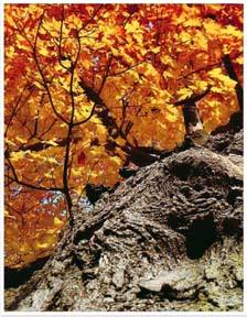
The byway is an 11.2-mile ridgetop route in the Daniel Boone NF which offers scenic views of wooded hills and Cave Run Lake. The wide, gently curving road is a popular route to see fall colors and view wildlife. Stops along the way provide spectacular views and a chance to view the abundant wildlife that lives in the area. Over 70 miles of hiking and horseback trails can be enjoyed.
The byway begins at Clear Creek Lake on FS129. The sparkling clear water is home to ducks and geese. Check out the trees and shrubs, warblers and sparrows are often seen foraging here. Check the edge of the lake, Louisiana Waterthrush can be found flipping over leaves, looking for food.
A stop at the historic Clear Creek Iron Furnace Picnic Area lets you wander back in time for a glimpse at one of Kentucky’s first industries. The skeleton of an iron furnace is the only remains of the once thriving noisy community. Today the only sound heard, is singing warblers, especially Cerulean warblers, singing high in the trees as they forage for food and look for mates.
From Clear Creek Iron Furnace turn right to FS918. Follow FS918 to the Buckskin Trail Head parking. There are many pull offs along thebyway but none as breathtaking as the view from Tater Knob Fire Lookout Tower. Tater Knob Tower, first constructed in 1934 was used as a lookout for fires until the mid-1970’. In 1993, it was restored and opened to the public. The more than 200 steps up to the tower and 35 more to the top of tower lets you view turkey vultures and hawks riding the wind currents over Cave Run Lake or just enjoy the beauty of the forest below.
While enjoying the byway, birding enthusiasts will want to drive FS 918A. This 2.6-mile gravel road promises Cerulean Warblers, American Redstart, Ovenbird and the flute like song of the Wood Thrush. Wild Turkey, grouse and deer can also be seen foraging along the road. Parking areas along the roadway makes this a great area to explore.
The byway ends at Zilpo Campground. A day-use fee is charged to enter Zilpo Campground if you are not camping. There are hiking trails and restrooms for your convenience. Deer, foxes and turkey are common sights. At night you can hear whip-or-wills and owls, during the day the campground comes alive with sparrows, eastern bluebirds and other songbirds. Overhead look for soaring osprey, eagles and hawks.