This trail takes one through a national park, across a ferry, through two state parks and a very popular city-owned park.
M1 - Mammoth Cave National Park
From I-65 North take exit 48 at Park City, Turn left and drive 10 miles west on KY 255 to visitor center.
An exemplar of KY's extensive subterranean landscape, this historic park is an International Biosphere Reserve and World Heritage Site. Above the longest cave system in the world are the endangered Egerts sunflowers and a 307-acre remnant of old-growth forest. Wide array of aquatic life including endangered mussels thrive in the Green and Nolin rivers.
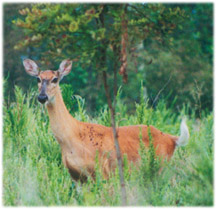
Wildlife Viewing Opportunities: White-tailed deer, wild turkey, raccoon and squirrel abound along rivers and park roadways. Hike any of the 70 miles of trails to see barred owl, whip-poor-will, wood thrush, eastern phoebe, blue jay, scarlet tanager and cardinal. Woodpeckers, chickadees, great blue heron, belted kingfisher, warblers, black duck, mallard, beaver, wildflowers, muskrat, snakes, turtles and frogs are found in the park. On roads, watch for cars stopping to view animals.
M2 – Nolin Lake Wildlife Management Area
Just N of Mammoth Cave is Nolin Lake Recreation Area Mammoth Cave Ferry will take you in close proximity to the new Nolin Lake State Park. Can also travel Hwy 259 through Brownsville to Hwy 728.
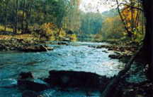
Habitat and Trail Info: Includes 5,210 acres and portions of shoreline. No camping is allowed. Terrain is rolling to rugged, with a mix of wooded areas, cleared fields and some wildlife food plots. Trail off Hwy 728 across from the Dam leads to the top of Dismal Rock with a breathtaking view of Nolin River.
Wildlife Viewing Opportunities: deer, squirrel, rabbit, quail and turkey. Hunting is allowed in small isolated areas, mostly accessible by boat.
M3 – Rough River Lake and Rough River Dam State Resort Park
From Nolin River Lake WMA take Hwy 728 to Hwy 259 to Rough River Lake, Dam and SRP.
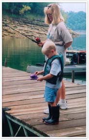
4860 acres offers some of the finest opportunities for fishing and water sports in the state. Beautiful lake views enhance the appeal of Rough River Dam Lodge. Water sports: marina, fishing and swimming.
Habitat and Trail Info: One mile trail connects lodge and marine areas with good opportunities for viewing shorebirds: woodland and edge species. .75 mile loop trail through woodland habitat near the campground.
Wildlife Viewing Opportunities: Geat waterway for wildlife viewing esp. by boat. Many aquatic birds, shore birds like great blue heron and green herons, osprey in spring and summer. Migrations will bring common loon, double crested cormorant and the sand hill crane passing through.
M4 – Yellowbank Wildlife Management Area
From Rough River take 105 North to McQuaday and then Hwy 261 to Hardinsburg. At Hardinsburg take Hwy 259 to Yellowbank WMA.
Habitat and Trail Info: 6000 acres that contain steep to moderate sloping woodlands, hardwood forest and flat river bottom farmlands. Several miles of maintained roads in the ara and many miles of old roads for hiking and sightseeing. Hiking trails (.6 miles, 2.5 miles loops).
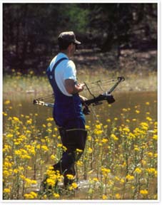
A 20-stop archery trail is open to the public. No broadhead use, field tips only. Archery trail is also nice hiking trail, all targets are off to the right of the trail. Horsebacking riding on designated roads and trails only (approx. 25 miles). No off-road/field/woods horse use. Fishing in area ponds and Yellowbank Creek. Boat ramp with access to Ohio River. Mobility impaired to permit holders. (502) 547-6856.
Wildlife Viewing Opportunities: Rabbit, quail, squirrel, dove, raccoon, groundhog, deer, turkey and some waterfowl. Abundant songbirds including many neotropical species: Acadian flycatcher, great crested flycatcher, northern parula, ovenbird, common yellowthroat, Kentucky warbler, red-eyed and yellow-throated vireo, indigo bunting, summer and scarlet tanager.
M5 – Lapland Wildlife Management Area
From Yellowbank WMA take Hwy 144 to Hwy 288 to Lapland WMA on Lapland Rd. Camping and lodging are available 15 miles east on Hwy 1638 at Otter Creek Park.
Habitat and Trail Info: 3,200 acres in Meade Co. Terrain consists of wooded, rugged featuring small cedar glades with native grasses and wildflowers.
Wildlife Viewing Opportunities: Squirrel, deer, turkey and numerous songbirds are found here. The cedar glades in summer bloom are worth the trip.
Brandenburg: The only downtown area in the state of Kentucky to have a Main Street that leads directly to the Ohio River.
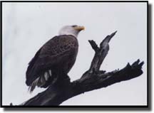
Riverfront Trail: gives views of the Ohio and the Matthew Welsh Bridge. Buttermilk Falls Trail: several waterfalls. 2.4 miles of trails provide easy walking while passing through several wooded area along the river. Facilities are found at the junction of the two trails. Wildlife viewing: Canada geese, great blue herons, bald eagles, gray squirrels, deer, beaver as well as array of songbirds.
M6 - Otter Creek Park
From Brandenburg take Hwy 1638. Follow signs.
3000 acres offer an abundance of outdoor experiences. The many events scheduled throughout the year include: trout fishing, rock climbing, repelling, birding events, caving, astronomy. (502) 574-4583.
Habitat and Trail Info: Forested in hardwoods and contains a freshwater wetland, cool and warm - water streams, croplands and pasture. Three hiking trails and an open pipeline that provides access to wildlifew viewers. Paved roads offer good wildlife viewing from the cars.
Wildlife Viewing Opportunities: White-tailed deer, groundhog, raccoon, striped skunk, opossum, chipmunk, bats and squirrels. Excellent birding.